
Alachua County GIS Newsletter

2026 Winter Edition

Map Genius Updates
Hope everyone is getting great use of the new Map Genius. Wanted to pass along some updates to the website.
New in Map Genius: One-Click Property Reports
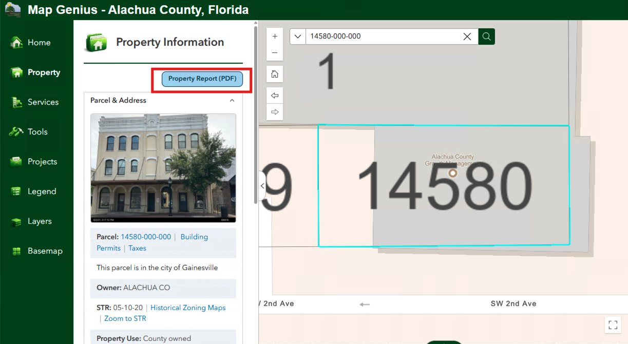
Map Genius can now turn everything it knows about a parcel into a printable report. Select any property in the county, open the Property panel, and click Property Report (PDF). A few seconds later you have a clean, shareable summary you can print or save.
Each report includes:
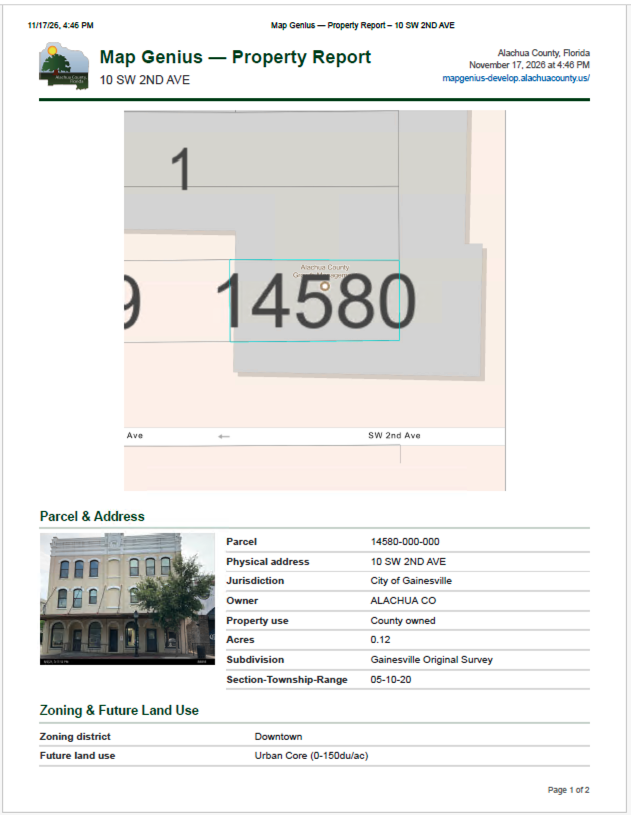
- A map and photo of the property, with the parcel centered and the layers you have turned on
- Parcel and address details: owner, physical addresses, acreage, buildings, subdivision and jurisdiction.
- Zoning and Future Land Use, with links to the regulations and the relevant Comprehensive Plan policies
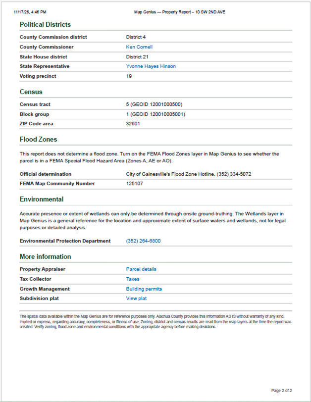
- Political districts: your County Commissioner, State Representative and voting precinct
- Census information: tract, block group and ZIP Code area
- Who to call for an official flood zone determination or questions about wetlands
- Quick links to the Property Appraiser, Tax Collector, building permits and the subdivision plat
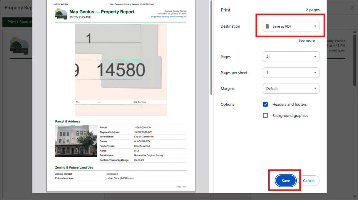
The report is built fresh each time from the same live map layers that power Map Genius, so it reflects the most current data available. To keep a copy, choose "Save as PDF" in the print window.
Try it at mapgenius.alachuacounty.us, search for an address or parcel number, then look for the blue button at the top of the Property panel.
Property Images
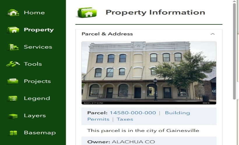
The GIS team has been able to include the static property images that come from the Appraisers office for most properties. If there is an image, it will display on the top of the Property tab in the information panel on the left after you select a property.
Historical Aerials
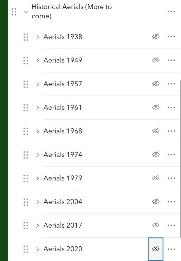
During the release of MapGenius, Historic Aerials had to be promptly removed due to difficulties with accessing them from other sources. We are processing the building of these layers to store on our server, and fortunately a majority of these are accessible again.
To turn on an aerial, scroll to the bottom of the layers tab to find the Historic Aerials group. So far, 10 layers have been posted ranging from 1938 to 2020.